
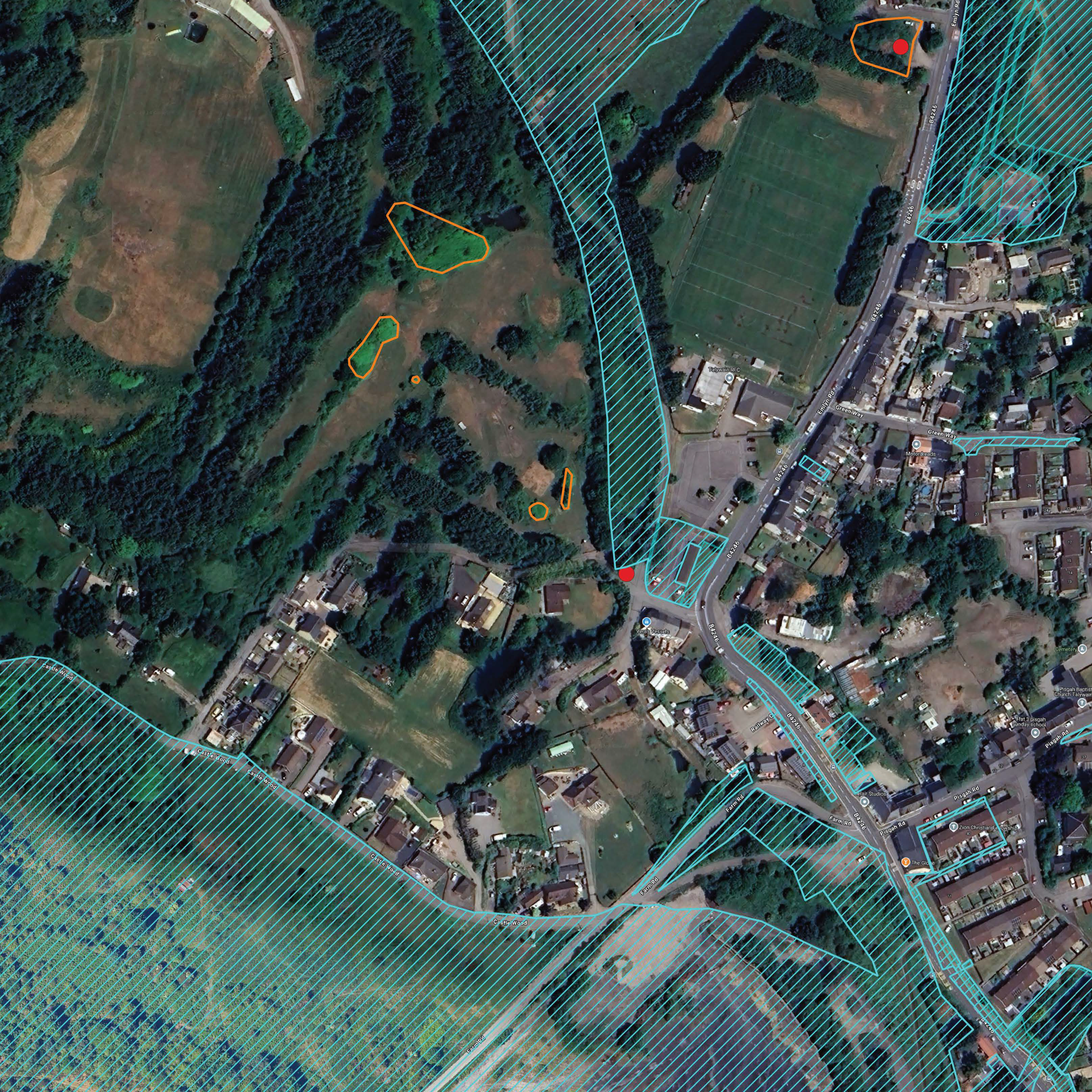
Managing an invasive species across an entire borough requires more than just treatment; it requires a deep historical memory. Torfaen County Borough Council (CBC) faced the challenge of managing a widespread, multi-decade infestation with records that were largely fragmented or stuck on paper.
Brief
This commission aimed to:
Provide a GIS mapping system to track, prioritise, and manage the infestation at the regional scale.
Critically review the Council’s long-term Japanese Knotweed management strategy.
What we did
Ai partnered with TR33 to build a bespoke digital solution that bridged the gap between historical data and modern fieldwork:
GIS development – developed a custom GIS mapping system that allowed the council to transition from paper records to a digital, real-time spatial map.
Forensic data integration – reviewed and integrated historical data from the ‘Managing Invasive Plants in the Heads of the Valleys Project’.
Timeline creation – by merging 2009-era data through to current site surveys, the team created a 20-year timeline of Knotweed movement and treatment efficacy across the region.
Operational streamlining – optimised the way data was collected in the field, ensuring that contractors and council staff were using the same high-accuracy reporting tools.
Key Outcomes
Ai and TR33 have a combined experience of more than 30 years mapping Japanese Knotweed and other key invasive plants. It is notable that our combined precision image analysis was highly accurate over space and time – only one historical Knotweed record was not found during the desk-based analysis but later found during field validation – this represented a detection accuracy of 99.6% across the 12,600-hectare Torfaen CBC estate.
The project delivered a ‘fit-for-purpose’ GIS tool that has since been adopted as the standard for the Council’s environmental management.
Administrative efficiency – drastically reduced time spent on manual data entry and ‘archaeological’ record-searching.
Treatment accuracy – improved the precision of treatment scheduling, ensuring that herbicides are applied only where necessary and at the optimum biological window.
Legal compliance – the Council can now provide empirical evidence of long-term progress, demonstrating high-level compliance with their legal duties to prevent the spread of invasive species.
Asset management – the system provides a clear roadmap for the eventual complete management of Knotweed across the borough, protecting land values and public infrastructure.
Project value
£0
Sectors
Summary
Advanced Invasives, in partnership with TR33, developed a sophisticated GIS-based management system for Torfaen County Borough Council to streamline the regional control of Japanese Knotweed across its 12,600-hectare estate. By forensically integrating fragmented paper and digital records spanning over 20 years, the project established a spatial timeline of the infestation with a 99.6% detection accuracy, enabling the Council to transition from reactive treatment to high-precision, data-led scheduling. This digital transformation significantly improved administrative efficiency, provided empirical evidence of long-term management progress and reduced treatment costs by effectively targeting Knotweed growth throughout the borough.